The planet’s damaged landscapes often resemble vast pages waiting to be rewritten. Over the last decade, drones and artificial intelligence have begun picking up the pen, sketching new lines of life across barren soil and wounded ecosystems. What used to take teams of field workers months of manual surveying, seed carrying, and data collection can now be done by a fleet of buzzing “sky gardeners” and algorithms with the attention span of a thousand owls. As ecological restoration surges in urgency, technology is no longer just a supportive tool. It has become an ecological partner, nimble and increasingly wise, coaxing nature toward recovery with an almost artisanal precision.
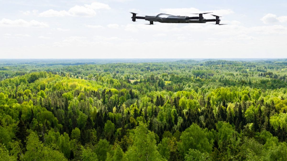
The Rise of the Restoration Drone
In many countries, drones have become the agile scouts of environmental repair. They sweep over forests, wetlands, and grasslands with cameras that read the landscape in textures and colors invisible to the human eye. Multispectral sensors detect moisture levels, canopy health, and soil stress. A single drone flight can map hundreds of hectares, offering restoration teams a rapid snapshot of what the land needs most.
A company in Australia, for instance, uses drones equipped with small seed pods to replant areas scorched by wildfires. Each pod carries a nutrient mix and a hardy seed selected specifically for the burned habitat. Instead of workers hiking through unstable terrain, drones swoop in like quiet pollinators, dropping life into the ash. According to global restoration groups, aerial seeding can be up to ten times faster than hand planting and far more consistent across difficult terrain.
In Kenya’s degraded savannahs, drones have recently been tested to distribute native grass seeds after years of overgrazing left the land bare. Early results show faster germination thanks to targeted seed placement informed by drone-collected soil moisture data. The process transforms drones from mere observers into ecological artisans, sculpting micro-patterns of regeneration.
AI: The Ecological Interpreter
If drones are the hands of modern restoration, AI is the mind. Land recovery demands constant monitoring: biodiversity counts, water quality metrics, and vegetation change. Decades ago, scientists recorded such data by foot and notebook. Now, AI systems digest satellite images, climate patterns, acoustic recordings, and drone footage to forecast how an ecosystem will behave months or even years ahead.
One conservation group in the Pacific uses AI to analyze underwater audio recordings and identify fish species by their distinct clicks, hums, and snaps. This “sound census” helps teams determine whether restored coral patches are attracting biodiversity back. In Brazil, AI models assist forest rangers by predicting which areas of newly regrowing forest are most vulnerable to illegal logging, enabling targeted patrols.
AI’s greatest strength lies in pattern recognition. A machine-learning model trained to spot invasive species can analyze thousands of aerial photos daily and highlight early intrusions long before humans would notice. Catching an invasive plant in its first season can prevent years of ecological damage. Instead of reacting to crises, restoration teams can work proactively, guided by AI’s quiet vigilance.
Precision at Planetary Scale
One of the great challenges of ecological restoration is scale. The United Nations estimates that more than 2 billion hectares of degraded land worldwide could be restored. Traditional restoration methods, though effective, move at a human pace. Drones and AI shift that pace closer to the rhythm required for global recovery.
In Canada, for example, reforestation teams are restoring sections of boreal forest affected by mining. AI analyzes aerial drone maps to determine optimal seed distribution zones based on slope, soil pH, existing growth, and predicted rainfall patterns. Once the plan is created, drones automatically fly predesigned routes, planting thousands of seeds per day. A restoration manager described the process as “landscape choreography,” with each drone following an invisible ecological script.
On coastal wetlands in Southeast Asia, drones help replant mangroves that once shielded villages from storms. Traditional planting requires wading through mud, a difficult and time-consuming task. With drone mapping and AI-guided planting, reforestation teams can identify stable mudflats, plant seedlings at precise tidal heights, and forecast which areas are most likely to survive future sea-level rise. The result is not just faster planting, but smarter planting.
Real-World Success Stories
Post-Wildfire Recovery in California
Following the catastrophic wildfires of 2018, some restoration crews embraced drone seeding for the first time. Drones carrying capsules of native seeds covered steep areas where foot access was unsafe. By the following spring, scientists recorded a measurable improvement in vegetation density and diversity in areas treated via drone, indicating that the method could speed recovery while reducing human risk.
Rebuilding Coral Ecosystems with AI
In the Maldives, a marine conservation initiative uses AI to sort coral fragments by health, species, and survival probability. Divers attach only the strongest fragments to underwater frames, significantly increasing regrowth success. AI predictions have improved survival rates from roughly 40% to over 65%, turning ocean restoration into a data-informed craft.
Desert Greening Projects in the Middle East
Teams restoring desert edges in Jordan use drones to distribute drought-resistant shrub seeds. AI modeling helps determine the most promising regions for establishing plant “islands,” which gradually stabilize soil and reduce erosion. Early pilot programs have already shown increased soil moisture retention and reduced surface temperature in restored patches.
Challenges and New Questions
Even with their futuristic charm, drones and AI are not magical solutions. They require skilled technicians, high-quality data, ethical guidelines, and the humility to work alongside natural processes rather than override them. In remote regions, drone batteries falter in extreme temperatures. AI models can fail when trained on biased or incomplete data. Some communities worry about surveillance implications if restoration drones fly near villages or farmland.
Ecologists also caution that large-scale technological restoration should not become an excuse for environmental neglect elsewhere. As one conservation scientist noted, “You still have to protect what’s standing. You can’t simply regrow what you destroy.” Technology amplifies human capacity; it cannot replace ecological responsibility.
The Future Landscape
Looking ahead, restoration technology is moving toward even greater synergy. Autonomous ground robots may eventually patrol newly restored forests to remove invasive seedlings. AI models could simulate entire ecosystems, offering previews of how a restored wetland might evolve over 20 years. Drone fleets may communicate with one another like cooperative flocks, distributing seeds, water, and nutrients in coordinated waves.
The emerging vision is a tapestry woven by both ecology and engineering: landscapes awakened with the help of airborne planters, digital naturalists, and silent algorithmic guardians. Rather than replacing nature, these tools act as catalysts, nudging wounded ecosystems toward their own inherent momentum for recovery.
In a world that has too often forgotten how to heal the land it lives upon, drones and AI offer a new chapter. They trace silver threads through damaged terrain, helping nature rise again. And as their capabilities grow, the planet’s quiet comeback may unfold not with dramatic spectacle, but with steady, almost poetic precision: one seed pod, one data point, one restored landscape at a time.